- Employee Spotlight, Success Stories
- Environmental Resource Assessment & Management
Employee Owners Nominated for NOAA Gold Medal Award

Congratulations to CSS employee owners supporting NOAA’s National Centers for Coastal Ocean Science for their nomination for the NOAA Gold Medal Award! CSS employee owners have been critical members of the team charged with the rapid development of spatial models that aid in offshore wind planning in the Gulf of Mexico. The team has collected authoritative data, developed maps and spatial models, engaged with partners, and managed the project to inform siting of ocean use, environmental review, and permitting. This effort provides guidance to the Bureau of Ocean Energy Management, the agency responsible for identifying and leasing wind energy areas. This is a tremendous accomplishment that advances the President’s offshore wind energy priority and notably reduces conflict.
A big congratulations to the entire team of NOAA and CSS employee owners on this well-deserved nomination!


See More CSS Insights
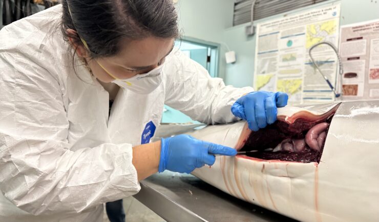
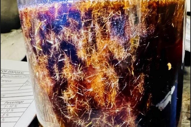
Assisting South Carolina Marine Mammal Stranding Network
CSS employee owner and Marine Mammal Microplastic Specialist supporting NOAA’s National Centers for Coastal Ocean Science assists the South Carolina Marine Mammal Stranding Network in responding to dead marine mammals when they strand on beaches or estuaries throughout South Carolina. This is work is critical for human and environmental health because it provides invaluable samples…
Training Staff for Handling Hazardous Waste and Responding to Chemical Spills
CSS employee owners provide on-site support to the Centers for Disease Control and Prevention (CDC) Hazardous Waste Program at several campuses around the country: Atlanta, Georgia, San Juan, Puerto Rico, and Fort Collins, Colorado. With 22 years of experience, CSS staff are responsible for providing training to laboratory and facilities staff to ensure safe handling of hazardous waste to avoid harmful…

55 Years of Earth Day!
Since April 22, 1970 — that’s 55 years! — we’ve celebrated Earth Day to raise environmental awareness and support for environmental protection. At CSS we have a passion for the environment and through various government contracts, we work with our clients to overcome challenges to help protect this rock we call home. Below are a…