
CSS is pleased to announce that NOAA has awarded our new Joint Venture (JV) with Research Planning, Inc. (RPI) a prime contract for two Professional, Science, and Technical Services (ProTech) program domains: ProTech Oceans 2.0, and ProTech Fisheries 2.0. This new RPI-CSS JV results from a Small Business Administration-approved Mentor-Protégé Agreement between CSS and RPI and opens the door for leveraging new partnerships and expanding contract opportunities.
NOAA ProTech Oceans 2.0 Domain – Work under this contract will support NOAA’s National Ocean Service in providing the data, tools, and services that support coastal economies and promote the development and management of the oceans and their resources. Our services for this domain are organized under five major program areas:
- Studies, Analyses, and Reports
- Applied Research, Development, Engineering, Consulting and Operations
- Field Sampling, Data Collecting, and Surveys
- Consulting, Program and Project Management
- Capacity Building
NOAA ProTech Fisheries Domain – Work under this contract will support NOAA’s National Marine Fisheries Service protected resources and habitat conservation efforts, and assist the NOAA Fisheries in promoting the conservation, management, and sustainable use of living marine resources. Our comprehensive services for this domain are organized under the following major program areas:
- Studies, Data Analyses, and Reports Applied Research, Engineering, Consulting, and Operations
- Field Sampling, Data Collection, and Surveys
- Training and Program and Project Management
- Fisheries Management and Consultation Activities
- Economic and Social Science
Visit our Contract Vehicle page for more information on CSS GSA schedules.
See More CSS Insights
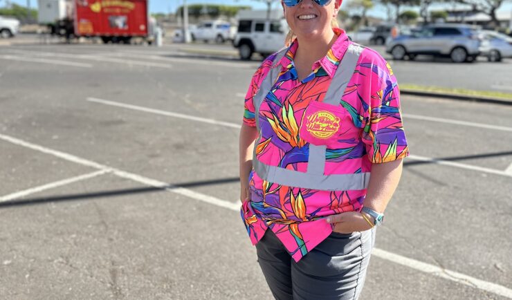
Assisting With Maui Wildfire Recovery
As part of our support to U.S. Environmental Protection Agency (EPA) Region 9 Superfund Technical Assessment & Response Team (START)—for which we are subcontracted through Weston Solutions, Inc.—CSS employee owners have been on-site in three-week rotations to assist throughout the rigorous recovery process.
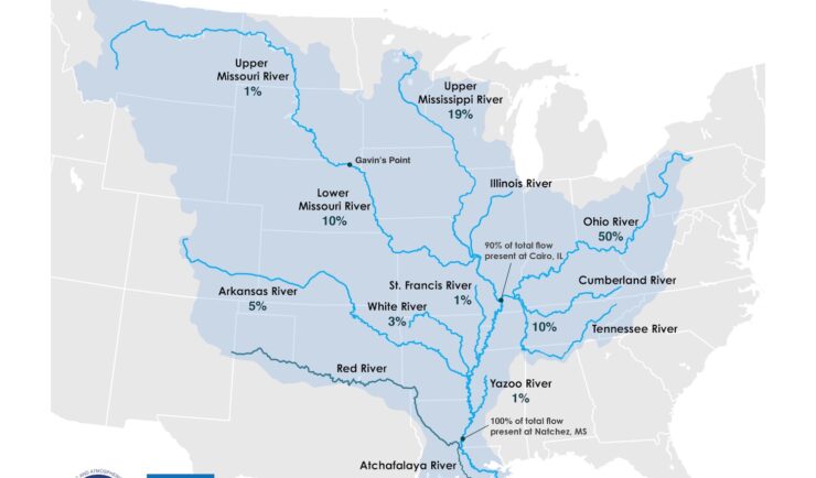
Supporting the Mississippi River Basin Drought and Water Dashboard Development
Congratulations to NOAA’s National Integrated Drought Information System (NIDIS) on the launch of the Mississippi River Basin Drought and Water Dashboard. This dashboard provides crucial, timely information to support decision-making for those living and working in the basin, which spans 31 states and 40 percent of the contiguous U.S. The team created the dashboard to…

55 Years of Earth Day!
Since April 22, 1970 — that’s 55 years! — we’ve celebrated Earth Day to raise environmental awareness and support for environmental protection. At CSS we have a passion for the environment and through various government contracts, we work with our clients to overcome challenges to help protect this rock we call home. Below are a…