Satellite Science & Environmental Intelligence
Helping create a more environmentally sustainable, weather-ready, and secure nation through application of earth observation data

About This Service
Our three-decade commitment to science-informed environmental intelligence through the systematic study of the structure and behavior of the ocean, land, atmosphere, and related ecosystems, to make critical decisions about life and property.
We transform environmental data into decisionable information to support conservation, regulation, and commerce.
Our goals include identifying data and interpreting environmental intelligence for natural resource management, security and defense applications.
Remote sensing data collected by satellites and radar, as well as terrestrial in situ and coastal and ocean data collected from crewed sailings and uncrewed observing systems offer a myriad of opportunities to monitor and measure changes in our earth’s environmental systems and human influences.
CSS-Riverside stands at the forefront of creating end-to-end system solutions through understanding the different observing systems, including satellite, terrestrial, and ocean-based platforms, to capture and sift through the various data streams, and understand their potential applications. CSS-Riverside develops strategies to integrate satellite data with ground- and ocean-based baseline studies, observe and understand changes and potential causes, to develop fundamental response, management and security issues.

Services include:
- Earth observations and satellite systems
- Data collection, capture, validation, and integration
- Data visualization and environmental system analytics
- Environmental data management, modeling, and analysis, including atmospheric, hydrologic, and climatic datasets
- Advanced algorithms for predictive modeling
- Design of user-focused climate data access tools and applications
- Cloud development, migration, and innovative data management initiatives
- Harnessing cloud capabilities to enhance data accessibility and scalability
- Applying Artificial Intelligence/Machine Learning to climate assessment and numerical weather prediction
- Communications and outreach
- User and stakeholder engagement
- Environmental data stewardship to unlock environmental intelligence
Related Projects

Ecologically Sound Offshore Wind Development
CSS helps set the standards for suitability modeling for offshore wind development, and assists in meeting regulatory standards for environmental resource protection.
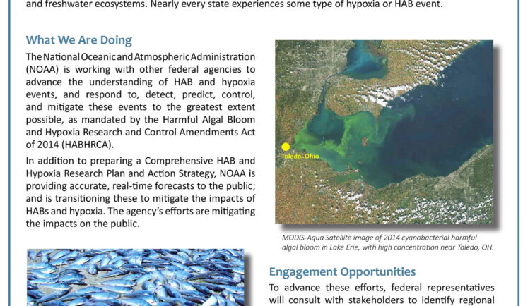
HABs Interagency Research and Action Plans
Our scientists helped set the standard for coordinated research and action to reduce the impacts of HABs.
Real-time HABs Detection and Modeling
We develop and deploy the sensors and monitor in real-time, HABs activities to support immediate response.
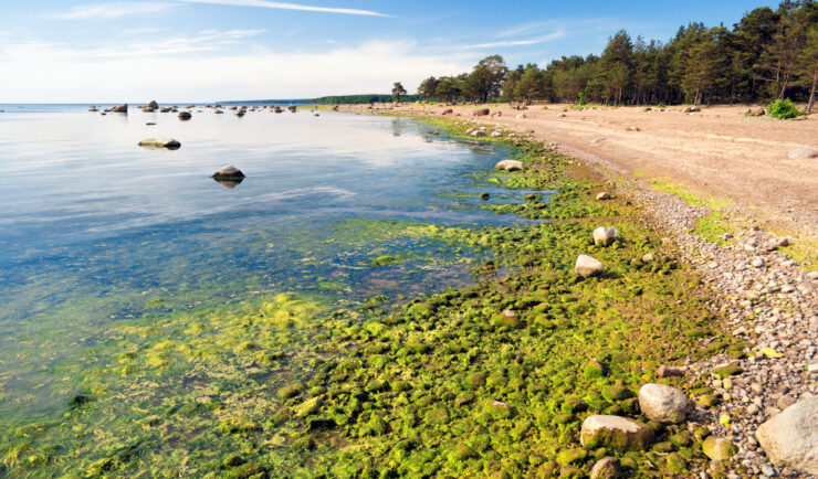
Harmful Algal Blooms (HABs)
We provide site-specific in situ monitoring coupled with predictive modeling, to provide an early warning system to advise health officials and resource managers on how to best focus their efforts to protect health and environment.
Predictive Modeling and the HABTracker
CSS scientists helped develop HABTracker, a HAB Forecast system.
Get in Touch
Contact us to learn more about our Satellite Data Applications services.