- Success Stories
- Emergency Preparedness & Response
Webinar Support for Emergency Chemical Release Response
Our staff on contract with the Environmental Protection Agency’s (EPA) Scientific and Technical Assistance for Consequence Management Team recently provided support for the development, coordination, and moderation of a pre-Operational Testing and Evaluation of Chemical Remediation Activities webinar for EPA On-Scene Coordinators. The EPA Office of Research and Development presented on the use of provisional advisory levels (PAL). The EPA Office of Emergency Management CBRN Consequence Management and Advisory Division (CBRN CMAD) presented on the process of chemical clearance during an emergency chemical release incident. Our staff assisted the EPA team in developing the event, acted as moderator, and provided technical support. This educational and interactive webinar was critical in providing the On-Scene Coordinators with information that will support them in their efforts during an emergency chemical release event. The webinar was a big success, with approximately 50 participants, and received very positive feedback from attendees.
 EPA Office of Emergency Management gave an interactive presentation on the clearance process after the release of a chemical warfare agent. |  EPA Office of Research and Development gave an interactive presentation on the use of PALs during an emergency chemical release event. |
See More CSS Insights
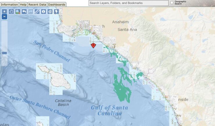
Ongoing Support for the Huntington Beach Oil Spill
Oil spills are disastrous and the clean-up is ongoing. Following the Huntington Beach, California oil spill in October 2021, our staff supported the National Oceanic and Atmospheric Administration’s Office of Response and Restoration with communications, data collection, and damage assessments. As various agencies collected data, our staff assisted the client in developing this map to…

Quality Assurance Audit Reports
Since 1985 we’ve supported the National Institute of Environmental Health Sciences and have provided more than 1,600 quality assurance audit reports that the client has used to assess the quality of toxicology studies they sponsor. Over the last year our employee owners reviewed several studies involving per- and polyfluorinated substances (PFAS) compounds, or “forever chemicals”,…
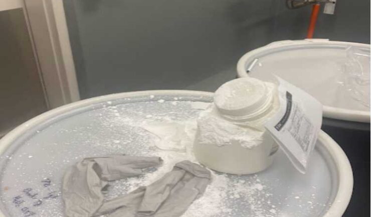
Rapid Reporting of a Close Call Incident
CSS Safety Protocols During a routine collection of waste, a container of white powder disintegrated without warning, causing the powder to spill and be expelled into the air. Thanks to CSS’s safety protocols and quick response, our Center for Disease Control waste disposal staff was able to assess the situation and respond to the chemical…