- Community Spotlight
- Environmental Resource Assessment & Management
Major Overhaul and Update to an Existing Tool
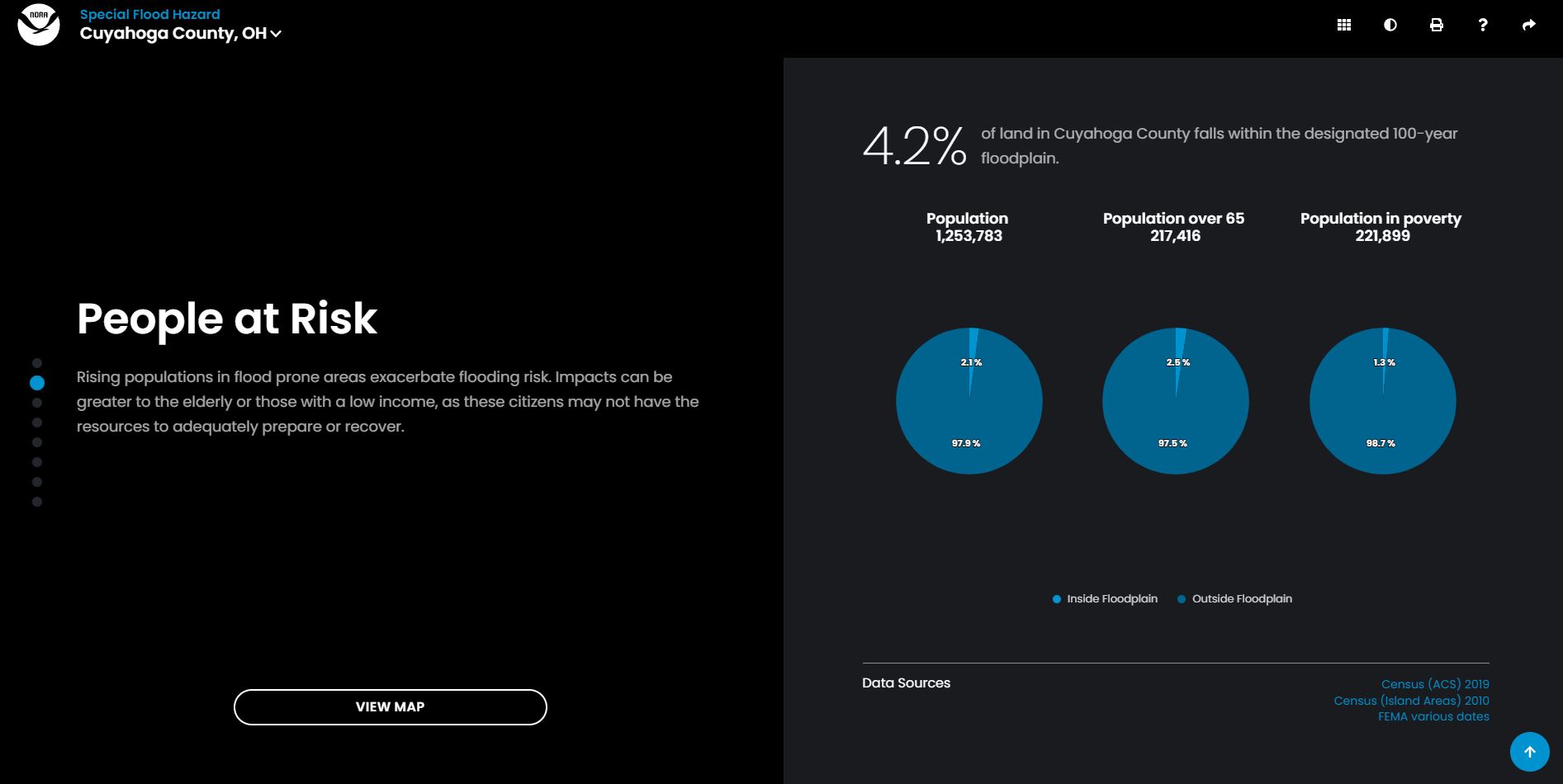
Congratulations to our staff on the highly anticipated new release of Coastal County Snapshots! Our staff are part of a larger team that includes the prime contractor, Lynker, Inc, and federal staff from the National Oceanic and Atmospheric Administration’s Office for Coastal Management who worked for over a year to complete this major task. Coastal County Snapshots provides county-level flood hazard, critical facility, job, and business data in an easy to understand format. The new version of the tool includes more contextual information, a more interactive interface, and two new snapshots not previously included: Total Coastal Economy and Sea Level Rise. Our staff provided data management, content development, and outreach support for this tool during this release and on a continuous basis.
Explore your Coastal County Snapshots.

See More CSS Community Spotlight

New Video: How NOAA and Engineers Are Future-Proofing America’s Infrastructure
CSS team members supporting NOAA’s National Centers for Environmental Information (NCEI) industry initiative are working with the architecture and engineering, insurance and reinsurance, and retail sectors to co-develop environmental data tools that are accessible and actionable, helping industries and communities build weather resilience. A new video showcases how NOAA data products, and this initiative, are equipping professionals to design…
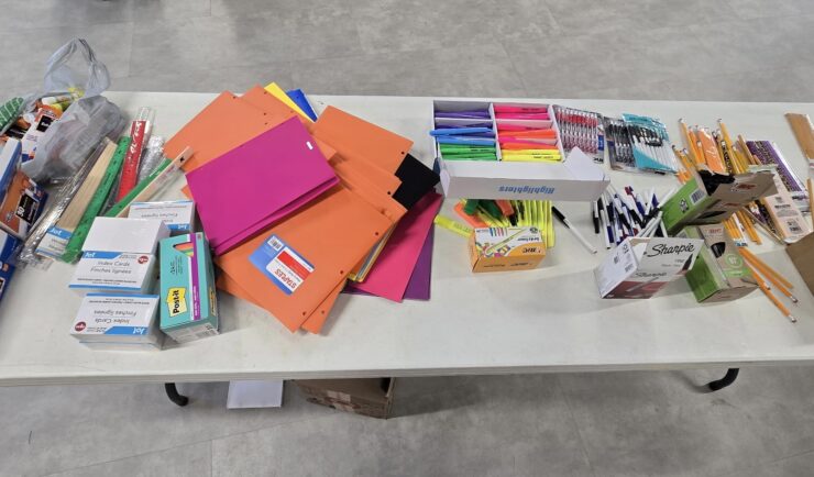
Hosting a Back-to-School Drive for Refugee Children in North Carolina
In August 2025, CSS hosted a back-to-school drive for child refugees in the North Carolina Triangle through CWS Durham, a non-profit specializing in refugee resettlement. With the help of many generous friends and family members, CSS successfully procured a backpack, lunchbox, water bottle, and clothes for 103 children, as well as stockpiles of 34 different essentials, covering school supplies, sanitary/hygiene items, food, and gift…
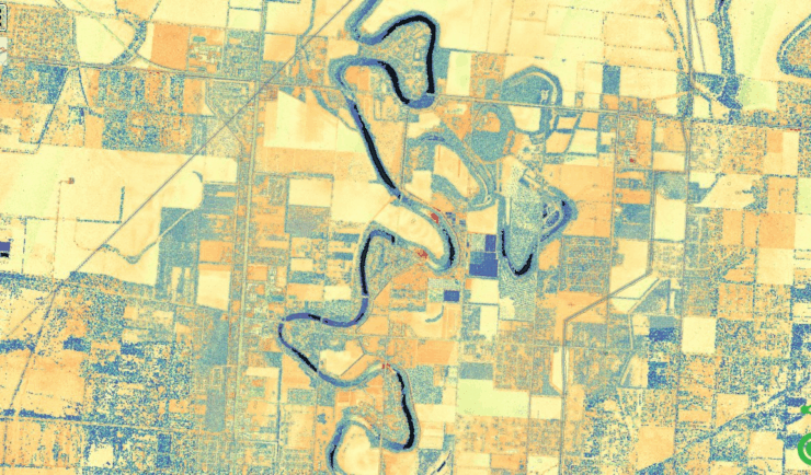
Developing and Managing Lidar Data
For over five years CSS employee owners have supported NOAA’s Digital Coast data development and management, training development and delivery, and tool development and management through our subcontract with Lynker Technologies supporting NOAA’s Office for Coastal Management. As part of this effort, CSS employee owners process lidar data from many sources to make it available…