- CSS News
- Environmental Resource Assessment & Management
Tracking Fish Through Restored Habitat
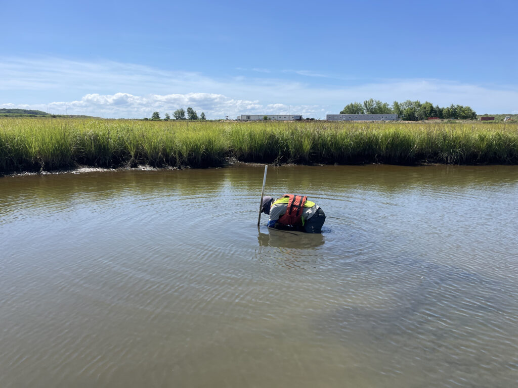
Poplar Island, a severely eroded remote island in the Chesapeake Bay, has been the site of a major restoration effort supported by CSS client, NOAA’s National Centers for Coastal Ocean Science (NCCOS), and their partners, Army Corps of Engineers, and the Maryland Department of Transportation, Maryland Port Administration. This massive effort utilizes dredge sediment from the shipping channel that leads to Baltimore Harbor to restore land mass lost to sea level rise and erosion. The goal is to rebuild natural habitats including wetlands, uplands, and embayments that provide critical habitat for birds and fish of the Chesapeake Bay. NCCOS and CSS scientists are studying this restored habitat and species that use the environment to help inform this restoration effort.
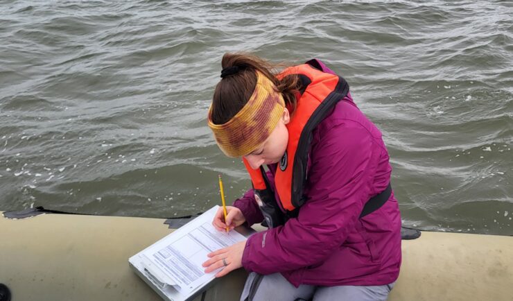
CSS employee owners work alongside federal program staff and local partners to collect samples throughout the regions. In fiscal year 2024 CSS staff deployed to the Gulf of Mexico and Pacific Ocean, which includes Alaska, Hawaii, and the West Coast. The team adds data they collect during these missions to the Coastal Pollution Data Explorer, a cloud-based ArcGIS platform that allows users to search by location or type of contaminant, generate a report, and download the data. A CSS employee owner serves as the lead developer for this online platform. Learn more about NOAA’s National Mussel Watch Program.


See More CSS Insights
New Data and Reports on the U.S. Marine Economy
Each year CSS economists on contract with NOAA’s Office for Coastal Management work with other federal agencies to process the most recent economic and labor data, and extract the portions related to marine-dependent sectors.
Organizing Teams to Monitor Coastal Contaminants
For nearly 40 years NOAA’s National Mussel Watch Program has been monitoring contaminants in coastal waters in over 400 sites around the U.S. by testing sediment and bivalves, such as oysters and mussels. A CSS employee owner organizes and coordinates the regional missions to collect and test samples. This includes developing a schedule and coordinating…
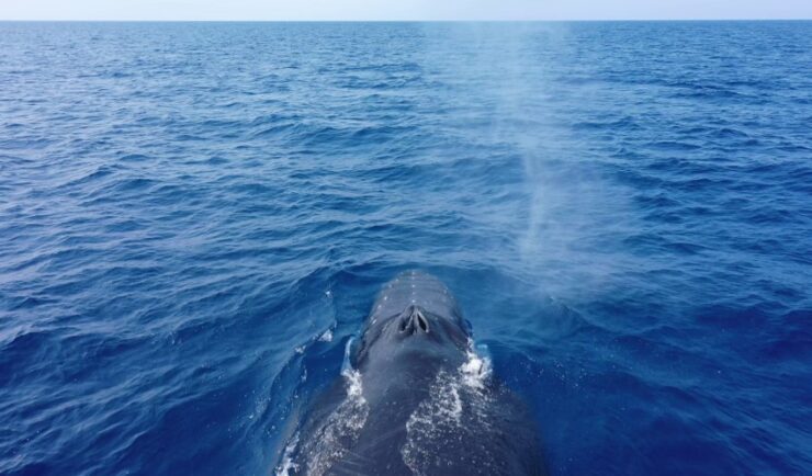
Training Marine Mammal Programs to Use Drones to Collect Dolphin and Whale Respiratory Health Data
CSS employee owner and Marine Mammal Drone Specialist supports NOAA’s National Centers for Coastal Ocean Science (NCCOS) Marine Mammal Health Assessment team with collecting respiratory health data from marine mammals in local waterways. Using specialized drones equipped with petri dishes provides a non-invasive method to collect exhaled breath (i.e. blow) samples from dolphins and whales.…