- Community Spotlight, Success Stories
- Environmental Resource Assessment & Management
Expanding a Popular Flood Exposure Tool
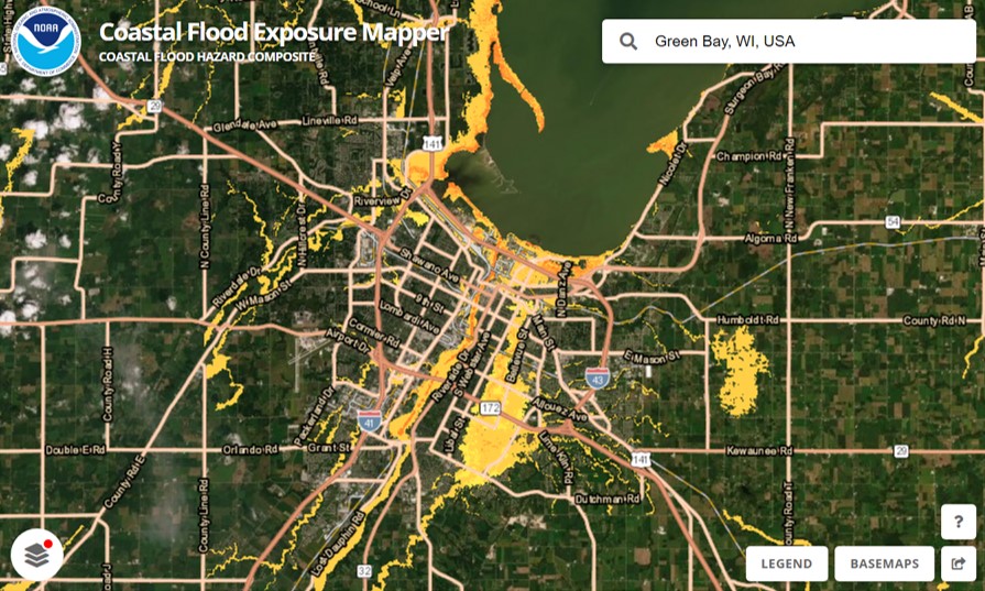
We recently assisted our client, the National Oceanic and Atmospheric Administration’s (NOAA) Office for Coastal Management, with updating one of their most popular tools, the Coastal Flood Exposure Mapper. Our staff provided data management, content development, and outreach support to expand the coverage to the U.S. Great Lakes for some of the flood layers, as well as to include tsunami zones for the East Coast. With this update, users can now view people, places, and natural resources exposed to new flood risks in areas previously not available.
In addition, our communication specialist recommended a higher level of outreach efforts for this expansion to more broadly advertise the implications for the Great Lakes region. This led to engaged interest from NOAA, congressional notifications, a press release, and social media rollouts.
Visit NOAA’s Digital Coast to explore this tool.
See More Success CSS Stories
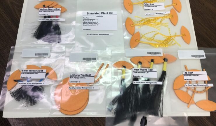
Astronauts Conduct Latest Plant Water Management on the International Space Station
NASA recently performed the sixth iteration of the CSS-supported Plant Water Management experiment on the International Space Station (ISS).
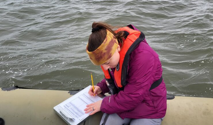
Organizing Teams to Monitor Coastal Contaminants
For nearly 40 years NOAA’s National Mussel Watch Program has been monitoring contaminants in coastal waters in over 400 sites around the U.S. by testing sediment and bivalves, such as oysters and mussels. A CSS employee owner organizes and coordinates the regional missions to collect and test samples. This includes developing a schedule and coordinating…
Developing a Database for Ecosystem Service Models
CSS scientists have been major developers and contributors to the online U.S. Environmental Protection Agency’s EcoService Models Library (ESML) database since its inception in 2012. The ESML database contains detailed but concise descriptions of ecosystem service models to facilitate the selection of models by ecosystem scientists for a variety of management and research applications. The…