- Community Spotlight, Success Stories
- Environmental Resource Assessment & Management
Expanding a Popular Flood Exposure Tool
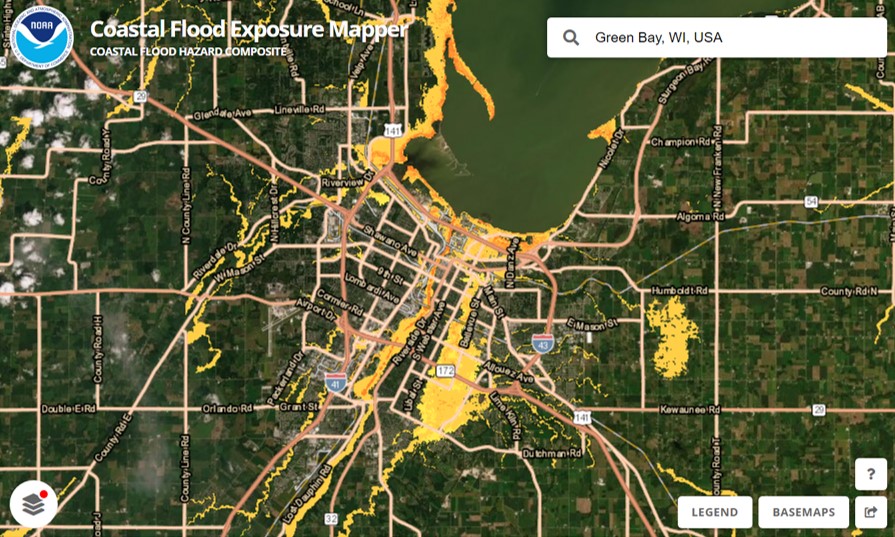
We recently assisted our client, the National Oceanic and Atmospheric Administration’s (NOAA) Office for Coastal Management, with updating one of their most popular tools, the Coastal Flood Exposure Mapper. Our staff provided data management, content development, and outreach support to expand the coverage to the U.S. Great Lakes for some of the flood layers, as well as to include tsunami zones for the East Coast. With this update, users can now view people, places, and natural resources exposed to new flood risks in areas previously not available.
In addition, our communication specialist recommended a higher level of outreach efforts for this expansion to more broadly advertise the implications for the Great Lakes region. This led to engaged interest from NOAA, congressional notifications, a press release, and social media rollouts.
Visit NOAA’s Digital Coast to explore this tool.
See More Success CSS Stories

Responding to Tangipahoa River Contamination
Following a fire at Smitty’s Supply facility in Louisiana’s Tangipahoa Parish on August 24, 2025, CSS employee owners supporting the Environmental Protection Agency’s Scientific Technical and Assessment for Consequence Management (STACM) contract deployed to the scene on August 31 to assist with response efforts. Initially staff worked on logistics at the staging warehouse. After a…
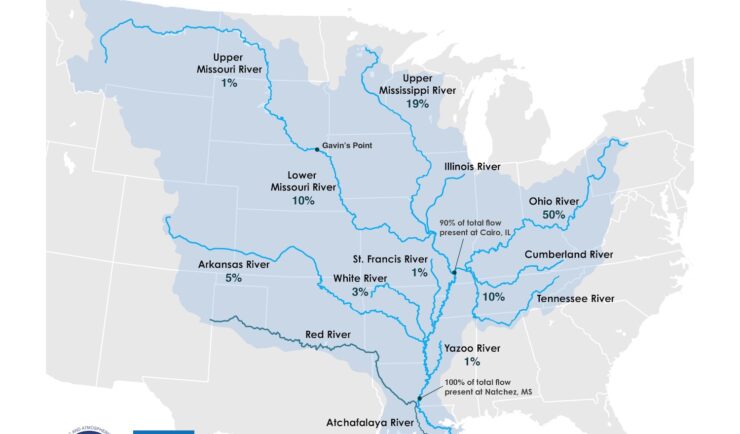
Supporting the Mississippi River Basin Drought and Water Dashboard Development
Congratulations to NOAA’s National Integrated Drought Information System (NIDIS) on the launch of the Mississippi River Basin Drought and Water Dashboard. This dashboard provides crucial, timely information to support decision-making for those living and working in the basin, which spans 31 states and 40 percent of the contiguous U.S. The team created the dashboard to…
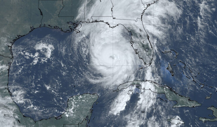
Hurricane Helene One Year Later: Shedding Light on the Impact
It’s been one year since Hurricane Helene caused catastrophic damage throughout the southern Appalachia region, especially Tennessee and North Carolina, where several rivers experienced above-record flooding. CSS employee owners (previously Riverside Technology, inc.) supporting NOAA’s National Centers for Environmental Information (NCEI) helped develop a Hurricane Helene StoryMap, Helene in Southern Appalachia, a dynamic tool that integrates diverse…