- Success Stories
- Environmental Resource Assessment & Management
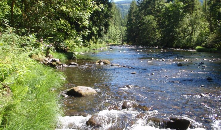
Developing a Stream Assessment Protocol
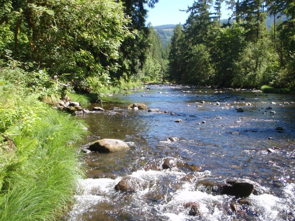
CSS has been a significant contributor to the development and implementation of the Oregon Stream Function Assessment Method (SFAM) for more than 10 years. SFAM is a key component of the Oregon Stream Mitigation Program administered by the Oregon Department of State Lands.
The mitigation program is designed to address damage to aquatic resources caused by permitted activities, such as road construction, and commercial building. CSS employee owners have provided support for method development including field trials, data analysis, and expertise in developing the Excel-based stream assessment scoring tool. In addition, CSS employee owners helped write the SFAM Manual and Scientific Rational support document. Visit Oregon Department of State Lands website to learn more about this program.

See More CSS Insights
Providing Data Products for More Effective Consumption
The National Oceanic and Atmospheric Administration’s (NOAA) National Centers for Environmental Information (NCEI) is responsible for providing data, products, and services that help businesses and organizations operate more efficiently and effectively. As such, these data and products need to be available in a publicly accessible and digestible format the audience are able to understand. To…
Over 2000 River and Stream Samples Analyzed
Every five years teams supporting U.S. Environmental Protection Agency’s National Aquatic Resource Survey—consisting of tribal, state, and federal partners—collect samples from over 2000 river and stream reaches throughout the United States. CSS analytical chemists support this effort by processing the samples and then analyzing them for various chemicals to help characterize their water quality. The…
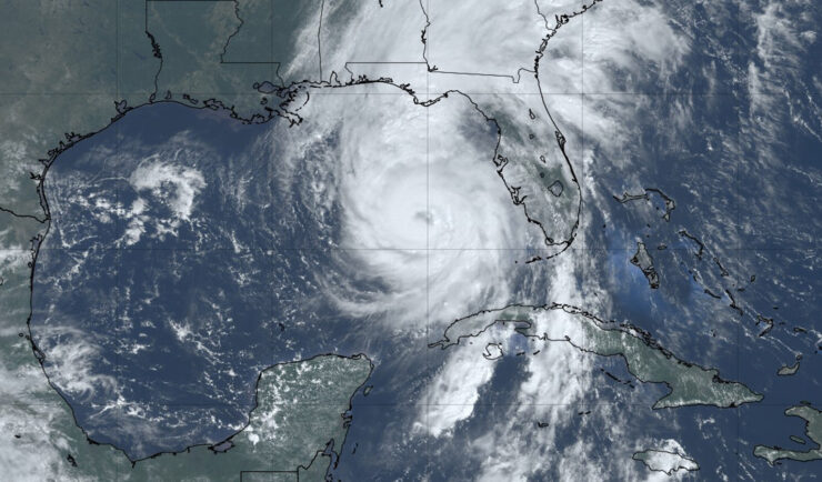
Hurricane Helene One Year Later: Shedding Light on the Impact
It’s been one year since Hurricane Helene caused catastrophic damage throughout the southern Appalachia region, especially Tennessee and North Carolina, where several rivers experienced above-record flooding. CSS employee owners (previously Riverside Technology, inc.) supporting NOAA’s National Centers for Environmental Information (NCEI) helped develop a Hurricane Helene StoryMap, Helene in Southern Appalachia, a dynamic tool that integrates diverse…