
- Community Outreach, Community Spotlight
Hosting a Back-to-School Drive for Refugee Children in North Carolina
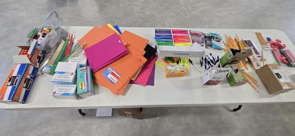
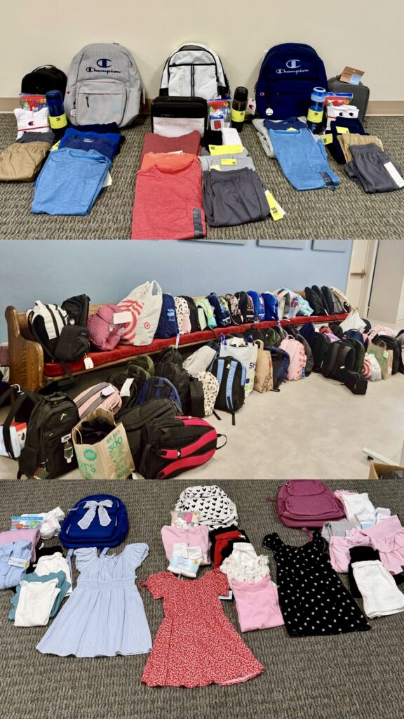
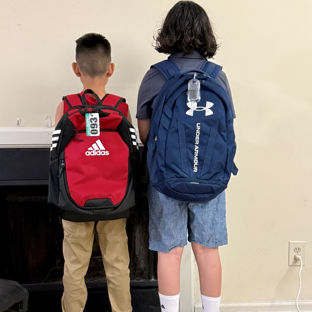
In August 2025, CSS hosted a back-to-school drive for child refugees in the North Carolina Triangle through CWS Durham, a non-profit specializing in refugee resettlement. With the help of many generous friends and family members, CSS successfully procured a backpack, lunchbox, water bottle, and clothes for 103 children, as well as stockpiles of 34 different essentials, covering school supplies, sanitary/hygiene items, food, and gift cards for flexible spending.
To coordinate the drive, one of our employee-owners, who previously volunteered as an English tutor for CWS, worked with their staff to create a comprehensive document outlining the specific needs of each child and the general needs of CWS clientele. CSS employees, as well as their friends and family members, then signed up to sponsor a child – procuring a backpack, lunchbox, water bottle, and clothing based on the child’s age, gender, sizes, and favorite colors – or to contribute items to the general stock. Supplies were carefully organized, packed up, and transported to the CWS Durham office for the official distribution event on August 21st. Upon arriving at the event, the children were excited to receive their new backpack – packed full of the items they’d requested – and then stop by various stations to pick out the school supplies. Their parents were able to pick up the sanitary/hygiene supplies and non-perishable foods they needed to help start a successful new school year.
The CWS staff who facilitated this event gave the following statement:
“We, at Church World Service Durham, were overwhelmed by the generosity of employees at CSS. They provided over 100 backpacks filled with school supplies and clothing to refugee children. The distribution event was very well-coordinated, and many children went home that day excited about the new school year and ready to learn. We cannot thank you enough.”
In the United States, refugees are defined as individuals who had their asylum case approved, meaning they fled their home country due to persecution based on race, religion, nationality, political opinion, or social group, and were granted legal status after undergoing a thorough screening and security clearance process. The 103 children we sponsored through this drive represent 11 countries of origin, which were experiencing severe humanitarian crises: Afghanistan, Burma, the Central African Republic, the Democratic Republic of Congo, El Salvador, Ethiopia, Mali, Honduras, Sudan, Syria, and Venezuela.
See More CSS Insights

Developing a Stream Assessment Protocol
CSS has been a significant contributor to the development and implementation of the Oregon Stream Function Assessment Method (SFAM) for more than 10 years. SFAM is a key component of the Oregon Stream Mitigation Program administered by the Oregon Department of State Lands. The mitigation program is designed to address damage to aquatic resources caused…
Maintaining Clean and Quality Control Standards
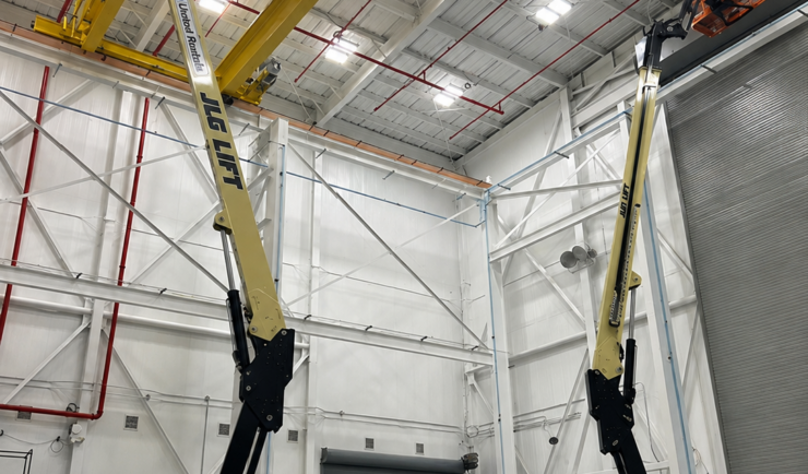
CSS delivers specialized cleanroom services for aerospace and other mission-critical environments. Our trained teams of employee owners safely operate high-reach industrial equipment around sensitive flight hardware and ground support equipment while maintaining strict cleanliness and contamination-control standards. From ongoing cleanroom maintenance and site-specific protocol development to workforce training, CSS provides the expertise needed to support safe, clean, and operationally ready facilities.
Expanding a Popular Flood Exposure Tool
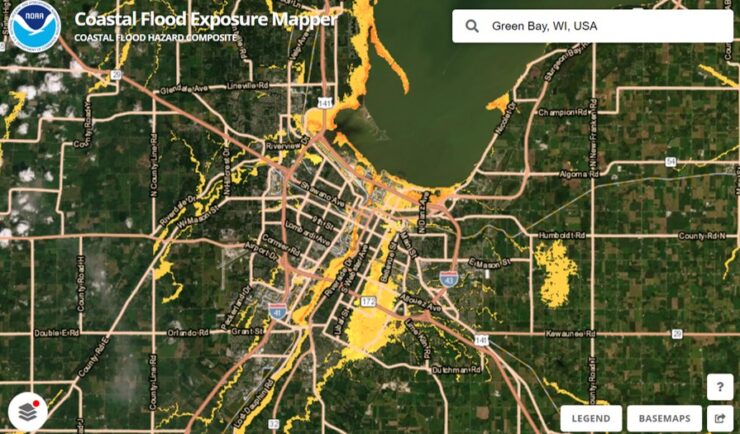
We recently assisted our client, the National Oceanic and Atmospheric Administration’s (NOAA) Office for Coastal Management, with updating one of their most popular tools, the Coastal Flood Exposure Mapper.