- Success Stories, Uncategorized
- Emergency Preparedness & Response
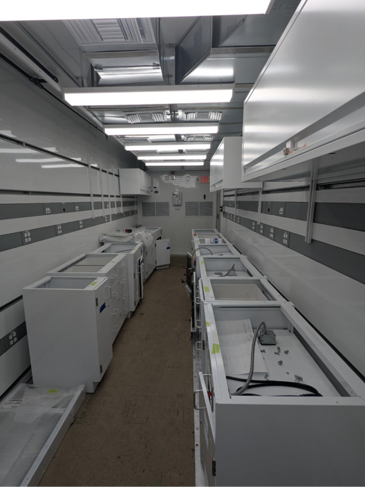
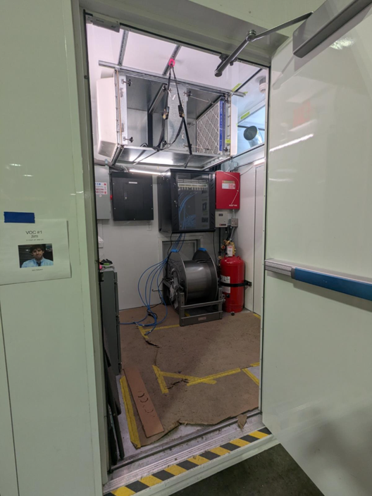
Assisting with Design and Validation of Mobile Chemical Analysis Laboratory

Portable High-throughput Integrated Laboratory Identification System (PHILIS) is the Environmental Protection Agency’s (EPA) suite of mobile laboratories designed to provide on-site analysis of chemical agents. CSS employee owners support the PHILIS team with on-site responses and chemical analysis. CSS PHILIS teams recently supported the technical design and integration of state-of-the-art emergency response mobile laboratory units engineered for the rapid detection and quantification of hazardous materials. CSS PHILIS teams in Castle Rock, Colorado and Edison, New Jersey collaborated with EPA and MRIGlobal — a research- and technology-focused contract company — representatives to orchestrate the configuration of Gas Chromatography-Mass Spectrometry, Liquid Chromatography-Tandem Mass Spectrometry, and preparatory systems to ensure benchtop-level performance under mobile conditions. CSS staff validated all critical support systems, including electrical, information technology (or IT), climate control system (or HVAC), vibration isolation, fume hoods, cabinetry and chemical storage, plumbing, power, fire, lighting, vacuum, and high-purity gas delivery systems. CSS chemistry staff upgraded and organized the current facility to best support the new laboratory units by implementing a transition and decontamination plan, installing an upgraded electrical system with higher voltage and amperage power supplies, and training staff on safe practices in use and movement of the new labs and equipment. CSS staff ensured that the laboratory adhered to safety standards while optimizing workflow for the hazardous material sample receiving, preparation, processing, analysis, and review while deployed to support EPA emergency response activities.
Visit EPA’s website to learn more about PHILIS.
See More CSS Insights

Responding to HazMat Spills
CSS supports several Centers for Disease Control and Prevention (CDC) campuses throughout the U.S. On-site CSS personnel are trained in hazardous material spill response and clean-up and provide this support within buildings and throughout campuses. As part of our contract with the CDC Hazardous Waste Program, CSS hazmat-trained employee owners are responsible for safely collecting,…

Over 40 Years of Support
Since 1982, members of our staff have supported EPA’s Office of Pesticide Programs. As part of this contract, our staff assess environmental and human health impacts on anthropogenic chemicals. The agricultural industry is critical to food and textile production, it is a large contributor to the U.S. economy. Not only does the industry provide food…

Developing a Stream Assessment Protocol
CSS has been a significant contributor to the development and implementation of the Oregon Stream Function Assessment Method (SFAM) for more than 10 years. SFAM is a key component of the Oregon Stream Mitigation Program administered by the Oregon Department of State Lands. The mitigation program is designed to address damage to aquatic resources caused…